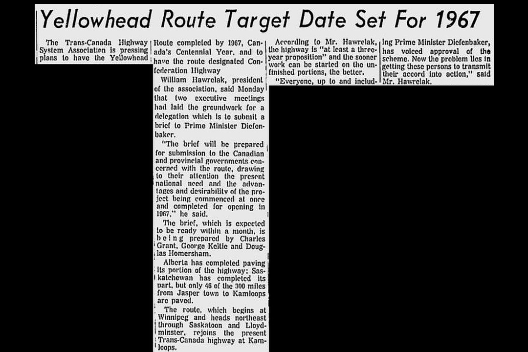
On this day in 1961, plans were underway that would eventually lead to the creation of the Yellowhead Highway and Edmonton's Yellowhead Trail.
These days, Yellowhead Trail is an extremely busy route in Edmonton. Up to 80,000 vehicles travel on it each day, with one-fifth of those vehicles being semi trucks or other heavy vehicles. But long before the highway was built, the route was part of an ancient trail that people had travelled for centuries.
The part of the highway that runs through Edmonton is known as the Yellowhead Trail. It's connected to the larger Yellowhead Highway, which runs for more than 3,000 kilometres from Haida Gwaii in British Columbia to Portage la Prairie in Manitoba. The highway gets its name from the Yellowhead Pass, which Indigenous peoples used for centuries as a path through the Rocky Mountains. The pass was later used by fur traders, and then the continental railroad was routed through it. The Yellowhead name supposedly comes from a blonde Métis explorer and fur trader named Pierre Bostonais, who led parties from the Hudson's Bay Company through the pass multiple times.
Almost as soon as cars hit city streets, there were calls for a highway to connect Edmonton to B.C. In the 1920s, an Edmonton automotive club even offered gold medals for the first successful car trip to Victoria through the Yellowhead Pass.
In the 1940s, demand for a trans-Canadian highway intensified, but much of the discussion focused on a highway that would run south through Calgary. In 1947, the Trans Canada Highway System (Yellowhead Route) Association, headed by then-Edmonton mayor Harry Ainlay, was formed. The group advocated for a second route that would connect people in the northern Prairies before heading through the Yellowhead Pass into northern B.C. Construction began, and the Yellowhead Highway officially opened in 1970.
But Yellowhead Trail, the Edmonton portion, would take a little longer to be built. During the 1960s, as Edmonton's footprint and traffic woes grew, there was increasing demand for a freeway through the city that could link up to the imminent highway system. Highway 16 already ran through Edmonton, but it twisted and turned as it did so, increasing travel time. During the 1960s, the METS development plan envisioned a loop of freeways surrounding downtown, including an east-west corridor at around 106 Avenue similar to the modern Yellowhead Trail. The entire plan was scrapped, however, as it included plans for a freeway running through the river valley, which was met with intense public protest.
With the METS plan abandoned, planners looked north for a bypass through the city for the existing Highway 16. They zeroed in on the collector roads that run along the CN Rail line at 125 Avenue. Using both municipal and provincial funds, work started to expand the route. The new Yellowhead Trail opened in 1970, although work to add lanes continued until 1984.
In the years since, Yellowhead Trail has seen more interchanges added as the city has grown, now stretching from the border of Strathcona County in the east to 213 Street in the west. With traffic estimates expected to double over the next 20 years, the city sought federal funds to convert Yellowhead Trail into a true freeway, with three lanes of free-flow traffic in both directions. The project is being funded by provincial and federal money, but that doesn't cover land purchases and other costs, meaning it was originally projected to cost the city around $510 million. But in December, city council announced a $105 million shortfall in the project, partially due to inflation and increased land prices.
This clipping was found on Vintage Edmonton, a daily look at Edmonton's history from armchair archivist Rev Recluse of Vintage Edmonton.

